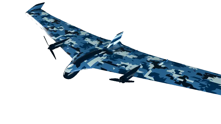
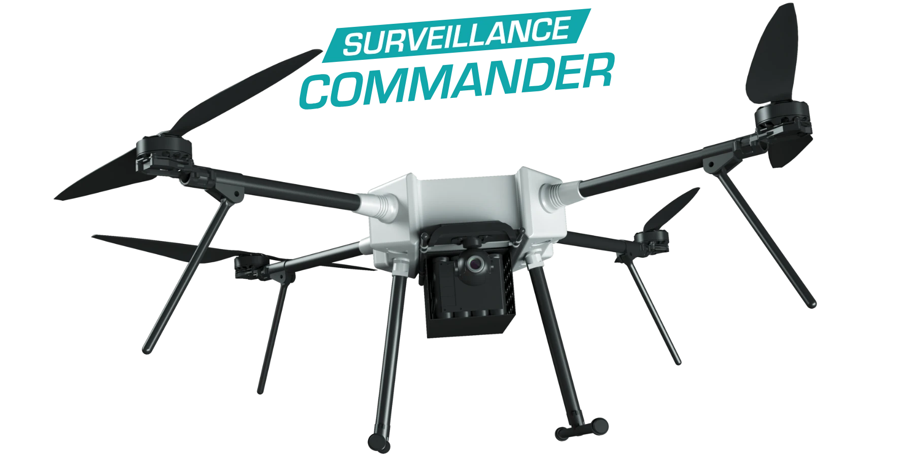
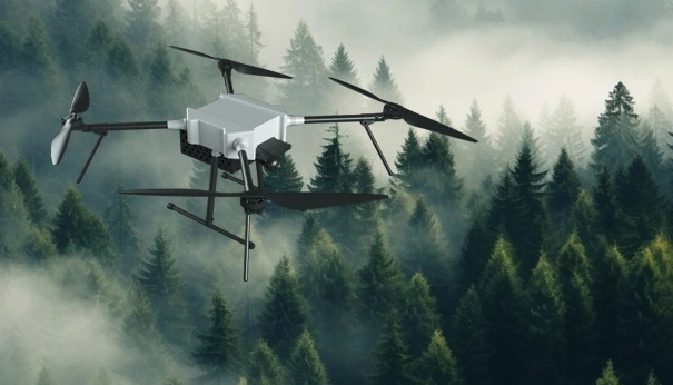
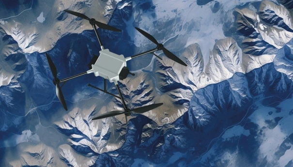
Surveillance Commander Long Range
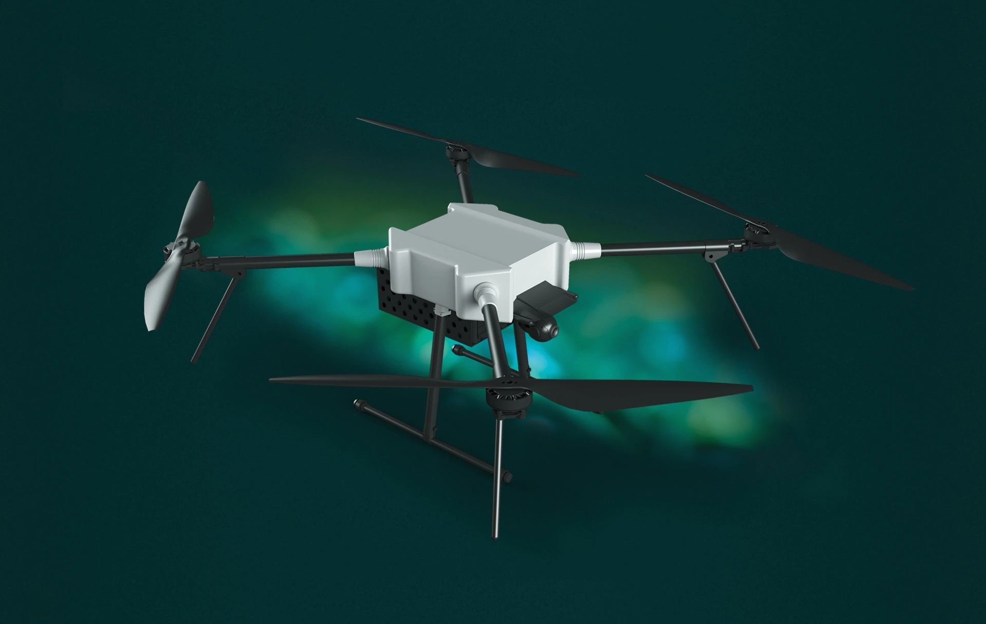
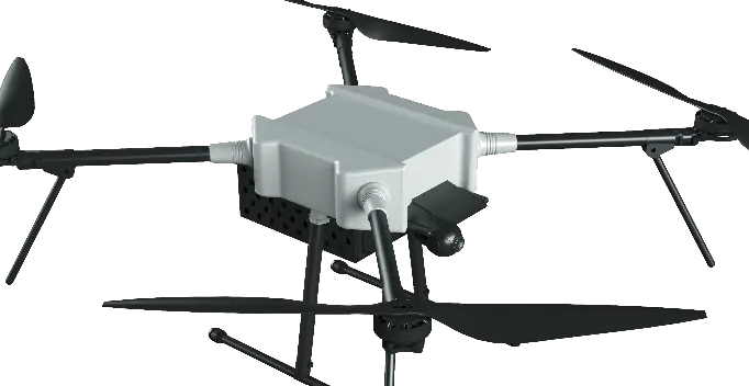
Discover the future of reconnaissance and surveillance with the Commander drone. Featuring a robust construction, an impressive flight time of 70 minutes, and autonomous navigation beyond communication range, this quadcopter ensures continuous operation in any environment. Equipped with an 8MP CMOS sensor, a 360-degree field of view, and a 30x optical zoom, the Commander drone captures high-resolution images from every angle, making it an invaluable tool for detailed analysis and intelligence gathering.
Technical Specifications Model 1:
- Dimensions with folded propellers: 1600mm x 160mm x 250mm
- Takeoff weight: 6kg
- Maximum flight time: 70 minutes
- Maximum horizontal speed: 40 km/h
- Communication range: FCC mode 16 km / CE mode 5 km
- Sensor: 8MP CMOS
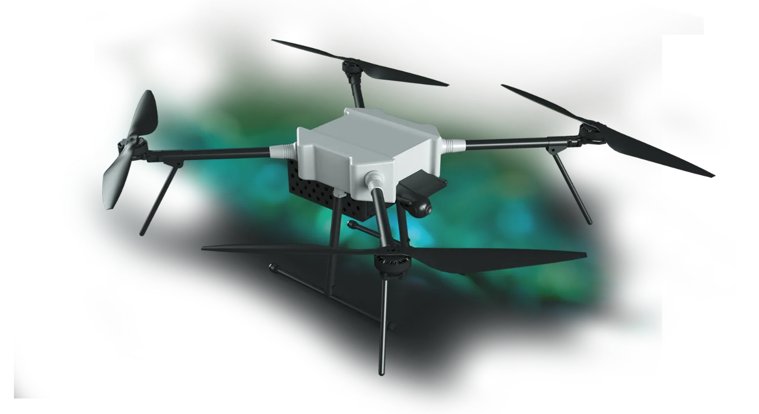
Technical Specifications Model 2:
- Field of view: 360°
- 30x optical zoom
- Thermal camera resolution: 640 x 512
- 4K 180x hybrid zoom
- 1200-meter laser rangefinder
- Supported AI object identification and tracking
AUTONOMOUS NAVIGATION BEYOND COMMUNICATION RANGE
Ensures continuous operation in remote or challenging environments.

IMPRESSIVE MAXIMUM FLIGHT TIME OF 70 MINUTES
Supports prolonged surveillance missions with continuous monitoring.
HIGH-RESOLUTION 8MP CMOS CAMERA
Provides detailed images, crucial for analysis and gathering intelligence information.
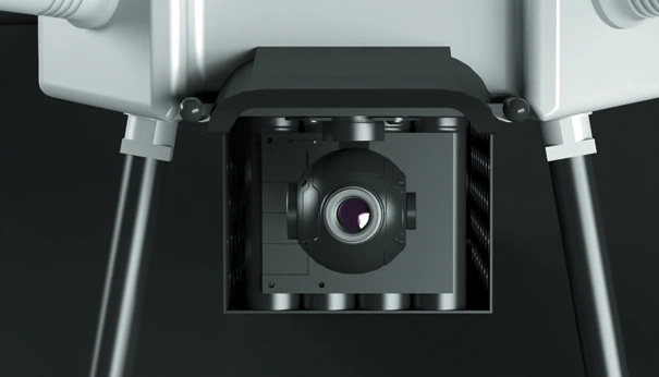

360-DEGREE FIELD OF VIEW
Captures a comprehensive image of the surrounding terrain, eliminating blind spots.
30X OPTICAL ZOOM
Enables precise inspection of distant objects and areas, providing clear, detailed images.

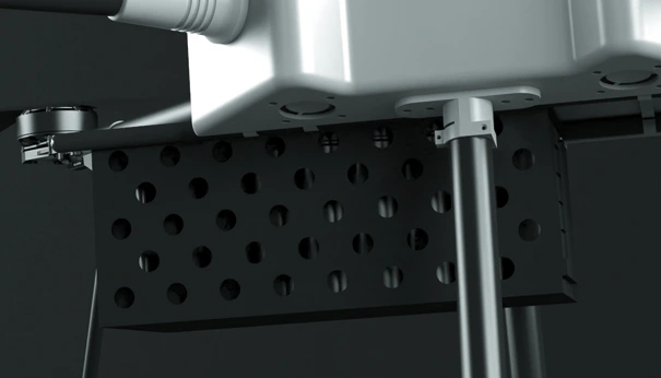
LOAD CAPACITY UP TO 1 KG
Allows for carrying additional equipment or sensors tailored to specific mission requirements.
MAXIMUM HORIZONTAL SPEED OF 40 KM/H
Enables rapid coverage of extensive areas in an efficient manner.
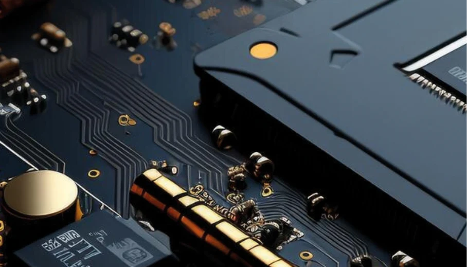
PROPRIETARY PCB COMPONENTS
We ensure high performance and reliability by utilizing proprietary components manufactured and assembled in Europe.
ROBUST CONSTRUCTION AND SIGNIFICANT DIMENSIONS
Provide stability and reliability in various operational conditions.
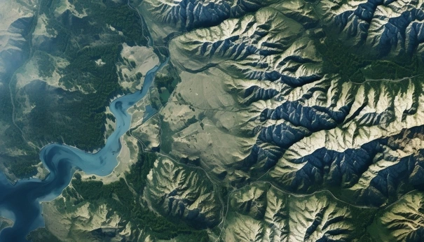
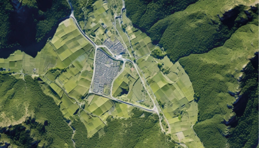
MAPPING AND AERIAL PHOTOGRAPHY CAPABILITIES
Essential for creating detailed maps and 3D terrain models for mission planning and environmental monitoring.
get intouch
London, United Kingdom
Headquarters


Rochester, USA
Representative Office
Malmo, Sweden
Representative Office
Cracow Poland Warsaw Poland
Representative Offices
Muscat, Oman
Representative Office
Vienna, Austria
Representative Office
We’re happy to hear from you!
Contact us today to learn more about our company and how you can benefit from working with us.
E-mail: [email protected]
Poland office: +48 668 424 500